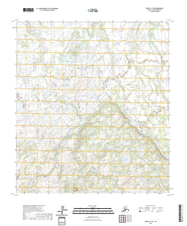
2023 Map of Denali C-5 SE
USGS Topo · Published 2023About this map
Denali National Preserve encompasses much of this interior Alaskan landscape, where the braided channels of the Foraker River and Herron River define the local drainage patterns. This recent 2023 survey illustrates the complex hydrology of the region, featuring Hot Slough in the northeast and the isolated Live Trap Lake tucked into the southern lowlands. The terrain is characterized by a dense network of unnamed streams and seasonal wetlands that feed into these major glacial rivers. As a contemporary topographic record, the map provides precise section and township boundaries, such as t15s r24w and t16s r23w, which help orient researchers within the roadless backcountry of the Denali Borough. The absence of built infrastructure emphasizes the preservation of this wilderness area.
Find a feature on this map
9 named features on this map. Tap any name to fly to it.
Don’t see what you’re looking for? This feature index may not catch every label — zoom into the map to look around manually.
Map Details
Editions of this 2023 Denali C-5 SE Map
This is the sole edition of this map. No revisions or reprints were ever made.
Other maps of this area

1952 · Mount McKinley
USGS Topo · 1:250,000

1953 · Mount McKinley C-5
USGS Topo · 1:63,360

1953 · Mount McKinley B-4
USGS Topo · 1:63,360

1953 · Mount McKinley B-5
USGS Topo · 1:63,360

1953 · Mount McKinley C-4
USGS Topo · 1:63,360

1954 · Mount McKinley C-4
USGS Topo · 1:63,360

1954 · Mount McKinley B-5
USGS Topo · 1:63,360

1954 · Mount McKinley C-5
USGS Topo · 1:63,360

1958 · Mount McKinley
USGS Topo · 1:250,000

1969 · Mount McKinley
USGS Topo · 1:250,000