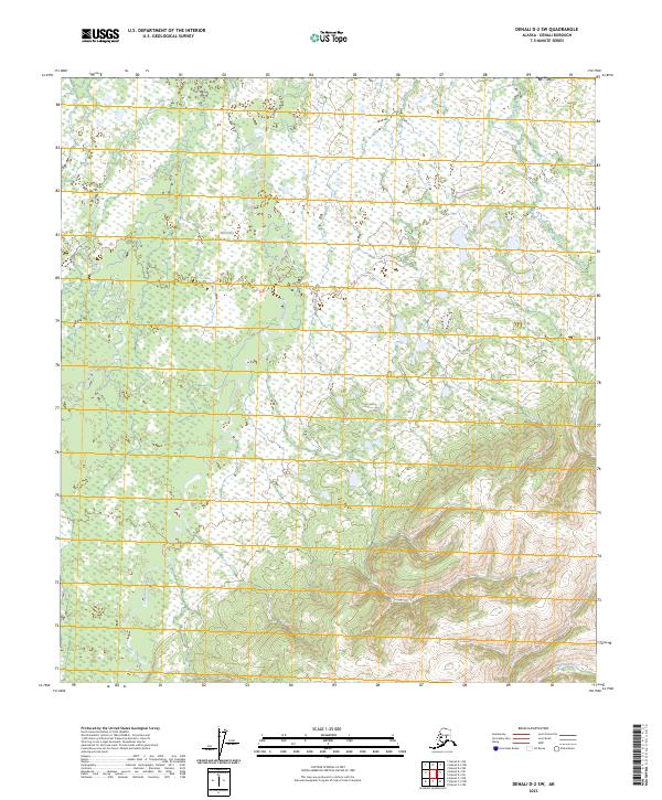
2023 Map of Denali D-2 SW
USGS Topo · Published 2023About this map
Denali National Park encompasses a significant portion of this interior Alaskan landscape, where the braided channels of the Bearpaw River dominate the central drainage system. This 2023 survey illustrates a wilderness defined by water and wetlands, with Moose Creek entering from the northwest and Otter Creek flowing through the northeastern corner. The topography transitions from the wet lowlands of the river basins into rising terrain toward the southeast, captured through precise contouring that reveals the natural relief of the Denali Borough. Aside from the hydrographic network and park boundaries, the land remains largely undeveloped, preserving a detailed look at the pristine drainage patterns and landforms of the subarctic environment.
Find a feature on this map
9 named features on this map. Tap any name to fly to it.
Don’t see what you’re looking for? This feature index may not catch every label — zoom into the map to look around manually.
Map Details
Editions of this 2023 Denali D-2 SW Map
This is the sole edition of this map. No revisions or reprints were ever made.
Other maps of this area

1952 · Mount McKinley
USGS Topo · 1:250,000

1952 · Mount McKinley C-3
USGS Topo · 1:63,360

1952 · Mount McKinley C-2
USGS Topo · 1:63,360

1952 · Mount McKinley D-3
USGS Topo · 1:63,360

1954 · Mount McKinley D-2
USGS Topo · 1:63,360

1954 · Mount McKinley C-2
USGS Topo · 1:63,360

1958 · Mount McKinley
USGS Topo · 1:250,000

1969 · Mount McKinley
USGS Topo · 1:250,000
2015 · Denali D-2 SE
USGS Topo · 1:25,000
2015 · Denali D-3 SE
USGS Topo · 1:25,000