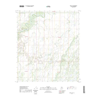
2023 Map of Denali D-3 NE
USGS Topo · Published 2023About this map
The Kantishna River meanders across this northern interior landscape, carving deep oxbows and abandoned channels through a complex wetland system. This wilderness area is partitioned between Denali National Preserve to the west and Denali National Park to the east, reflecting the intricate land management boundaries established to protect the diverse ecosystem of the Denali region. The terrain is characterized by a low-lying fluvial plain where Bear Creek flows through the southeastern portion of the quadrangle. The map documents the shifting hydrology and vast marshes typical of the subarctic river systems, where the lack of permanent settlements or infrastructure underscores the preserved natural state of this protected territory.
Find a feature on this map
9 named features on this map. Tap any name to fly to it.
Don’t see what you’re looking for? This feature index may not catch every label — zoom into the map to look around manually.
Map Details
Editions of this 2023 Denali D-3 NE Map
This is the sole edition of this map. No revisions or reprints were ever made.
Other maps of this area

1948 · Kantishna River
USGS Topo · 1:250,000

1951 · Kantishna River
USGS Topo · 1:250,000

1952 · Mount McKinley
USGS Topo · 1:250,000

1952 · Kantishna River A-3
USGS Topo · 1:63,360

1952 · Kantishna River
USGS Topo · 1:250,000

1952 · Kantishna River A-2
USGS Topo · 1:63,360

1952 · Mount McKinley D-3
USGS Topo · 1:63,360

1953 · Kantishna River A-3
USGS Topo · 1:63,360

1954 · Mount McKinley D-2
USGS Topo · 1:63,360

1958 · Mount McKinley
USGS Topo · 1:250,000