
1953 Map of Kantishna River A-3
USGS Topo · Published 1974About this map
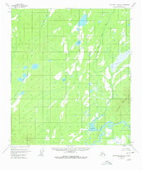
The Kantishna River winds through this interior Alaskan wilderness, defining the eastern boundary of a landscape dominated by shifting waterways and muskeg. Mapped from 1952 aerial photography, the sheet documents the intricate drainage patterns of the John Hansen Creek system as it feeds into John Hansen Lake. To the southeast, the terrain rises sharply toward the heights of Bearpaw Mountain, providing a stark contrast to the low-lying wetlands that characterize much of the quadrangle. Aside from the named natural features such as Square Lake and Jeannes Lake, the map reflects a region of the Yukon-Koyukuk territory without established roads or permanent settlements in the early 1950s, serving as a primary record of the hydrological network before minor revisions were noted in the 1970s.
Find a feature on this map
6 named features on this map. Tap any name to fly to it.
Don’t see what you’re looking for? This feature index may not catch every label — zoom into the map to look around manually.
Map Details
Editions of this 1953 Kantishna River A-3 Map
3 editions found
Other maps of this area

1948 · Kantishna River
USGS Topo · 1:250,000

1951 · Kantishna River
USGS Topo · 1:250,000

1952 · Mount McKinley
USGS Topo · 1:250,000

1952 · Kantishna River A-3
USGS Topo · 1:63,360

1952 · Kantishna River
USGS Topo · 1:250,000

1952 · Kantishna River A-2
USGS Topo · 1:63,360

1952 · Mount McKinley D-3
USGS Topo · 1:63,360

1953 · Kantishna River B-2
USGS Topo · 1:63,360

1953 · Kantishna River B-4
USGS Topo · 1:63,360

1953 · Kantishna River A-4
USGS Topo · 1:63,360