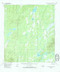
1953 Map of Kantishna River A-3
USGS Topo · Published 1986About this map
The Kantishna River winds through this interior landscape, defined by a complex network of wetlands and seasonal drainages. During the early 1950s, this area remained largely unsurveyed on the ground, with the Bureau of Land Management establishing predetermined locations for future land lines. The topography is dominated by the sprawling wetlands around John Hansen Lake and smaller bodies of water like Square Lake and Jeannes Lake. To the southeast, the terrain rises sharply toward Bearpaw Mountain, offering a stark contrast to the low-lying basins of John Hansen Creek. This document captures the wilderness state of the region before significant modern development, emphasizing the natural hydrology and the early application of photogrammetric mapping techniques in the Alaskan interior.
Find a feature on this map
6 named features on this map. Tap any name to fly to it.
Don’t see what you’re looking for? This feature index may not catch every label — zoom into the map to look around manually.
Map Details
Editions of this 1953 Kantishna River A-3 Map
3 editions found

Other maps of this area

1948 · Kantishna River
USGS Topo · 1:250,000

1951 · Kantishna River
USGS Topo · 1:250,000

1952 · Mount McKinley
USGS Topo · 1:250,000

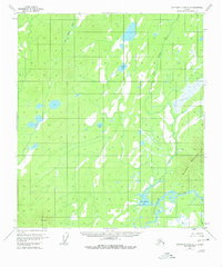
1952 · Kantishna River A-3
USGS Topo · 1:63,360

1952 · Kantishna River
USGS Topo · 1:250,000

1952 · Kantishna River A-2
USGS Topo · 1:63,360

1952 · Mount McKinley D-3
USGS Topo · 1:63,360

1953 · Kantishna River B-2
USGS Topo · 1:63,360

1953 · Kantishna River B-4
USGS Topo · 1:63,360

1953 · Kantishna River A-4
USGS Topo · 1:63,360