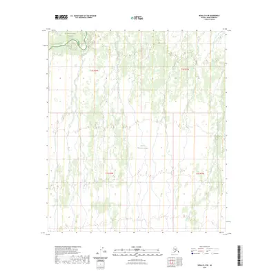
2023 Map of Denali D-3 SW
USGS Topo · Published 2023About this map
The northern boundary of Denali National Preserve meets the vast expanses of Denali National Park in this remote Alaskan wilderness. This 2023 survey provides a clean cartographic record of a landscape defined by braided river systems and complex wetlands, captured by SPOT imagery in 2009. The map details the transition between these two protected areas within the Denali Borough, showing the absence of established roads or settlements in this portion of the interior. The survey is organized by the Public Land Survey System, specifically detailing portions of t12s r20w, t12s r19w, t13s r20w, and t13s r19w. It serves as a modern baseline for the hydrological shifts and natural boundaries of this subarctic environment.
Find a feature on this map
6 named features on this map. Tap any name to fly to it.
Don’t see what you’re looking for? This feature index may not catch every label — zoom into the map to look around manually.
Map Details
Editions of this 2023 Denali D-3 SW Map
This is the sole edition of this map. No revisions or reprints were ever made.
Other maps of this area

1952 · Mount McKinley
USGS Topo · 1:250,000

1952 · Mount McKinley C-3
USGS Topo · 1:63,360

1952 · Mount McKinley D-3
USGS Topo · 1:63,360

1953 · Mount McKinley C-4
USGS Topo · 1:63,360

1953 · Mount McKinley D-4
USGS Topo · 1:63,360

1954 · Mount McKinley C-4
USGS Topo · 1:63,360

1954 · Mount McKinley D-4
USGS Topo · 1:63,360

1958 · Mount McKinley
USGS Topo · 1:250,000

1969 · Mount McKinley
USGS Topo · 1:250,000
2015 · Denali C-4 NE
USGS Topo · 1:25,000