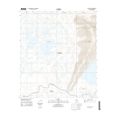
2015 Map of Denali D-4 NE
USGS Topo · Published 2015About this map
Denali National Preserve and Denali National Park meet in this interior landscape, where complex wetland systems and river braids dominate the terrain. The topography is defined by the winding course of the Muddy River as it flows toward its confluence, while further south, Birch Creek meanders across the lower sections of the quadrangle. This 2015 survey illustrates a wilderness nearly devoid of human infrastructure, focusing instead on the hydrological network of the Kantishna River basin. Scattered water bodies like Big Lily Lake, Starr Lake, and Chilchukabena Lake provide key landmarks within the expansive flats. The lack of roads or established settlements emphasizes the protected, roadless character of the region, making it an essential reference for understanding the natural drainage patterns and land management boundaries of this subarctic environment.
Find a feature on this map
14 named features on this map. Tap any name to fly to it.
Don’t see what you’re looking for? This feature index may not catch every label — zoom into the map to look around manually.
Map Details
Editions of this 2015 Denali D-4 NE Map
This is the sole edition of this map. No revisions or reprints were ever made.
Other maps of this area

1948 · Kantishna River
USGS Topo · 1:250,000

1951 · Kantishna River
USGS Topo · 1:250,000

1952 · Mount McKinley
USGS Topo · 1:250,000

1952 · Kantishna River A-3
USGS Topo · 1:63,360

1952 · Kantishna River
USGS Topo · 1:250,000

1952 · Mount McKinley D-3
USGS Topo · 1:63,360

1953 · Kantishna River A-4
USGS Topo · 1:63,360

1953 · Mount McKinley D-4
USGS Topo · 1:63,360

1953 · Kantishna River A-3
USGS Topo · 1:63,360

1954 · Mount McKinley D-4
USGS Topo · 1:63,360