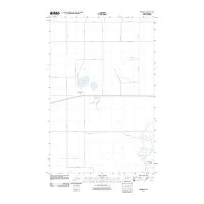
2011 Map of Denbigh
USGS Topo · Published 2011About this map
Denbigh serves as the primary settlement center in this McHenry County landscape, situated near the western edge of the quadrangle. The terrain is defined by the winding course of the Souris River in the southeast corner and the presence of Spring Lake just north of the village. The surrounding area is structured by a methodical grid of rural roads, including Center Ave N and several numeric routes like 66th St N, which facilitate movement across the agricultural plains. A notable transportation feature is the Leach Ranch Landing Strip located near the river's loops, indicating the importance of private aviation in this prairie region. The layout of Sandhills Rd suggests local variations in the topography of the northern Great Plains during the early 21st century.
Find a feature on this map
22 named features on this map. Tap any name to fly to it.
Don’t see what you’re looking for? This feature index may not catch every label — zoom into the map to look around manually.
Map Details
Editions of this 2011 Denbigh Map
This is the sole edition of this map. No revisions or reprints were ever made.
Other maps of this area

1949 · Riga
USGS Topo · 1:24,000

1949 · Karlsruhe NW
USGS Topo · 1:24,000

1949 · Denbigh
USGS Topo · 1:24,000

1949 · Bantry
USGS Topo · 1:24,000

1950 · Karlsruhe NE
USGS Topo · 1:24,000

1950 · Towner NW
USGS Topo · 1:24,000

1950 · Towner
USGS Topo · 1:24,000

1950 · Denbigh
USGS Topo · 1:24,000

1950 · Bantry NW
USGS Topo · 1:24,000

1950 · Bantry
USGS Topo · 1:24,000