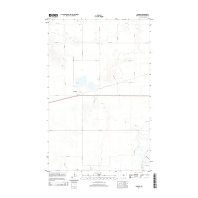
2014 Map of Denbigh
USGS Topo · Published 2014About this map
Denbigh is the focal point of this McHenry County survey, situated at the junction of Us-2 and several rural roads that define the regional grid. The landscape is characterized by the winding path of the Souris River in the southeast and the quiet waters of Spring Lake to the north. This 2014 mapping reflects a modern era of the North Dakota plains, where traditional section lines like 60th St N and Center Ave N coexist with newer arterial routes. The topography reveals the intricate drainage patterns around Sand Hills Rd, highlighting the unique glacial terrain that defines the area between the settlement and the river valley. Researchers can observe how the local infrastructure, including Prairie View Rd, facilitates access to the surrounding agricultural and natural features.
Find a feature on this map
26 named features on this map. Tap any name to fly to it.
Don’t see what you’re looking for? This feature index may not catch every label — zoom into the map to look around manually.
Map Details
Editions of this 2014 Denbigh Map
This is the sole edition of this map. No revisions or reprints were ever made.
Other maps of this area

1949 · Riga
USGS Topo · 1:24,000

1949 · Karlsruhe NW
USGS Topo · 1:24,000

1949 · Denbigh
USGS Topo · 1:24,000

1949 · Bantry
USGS Topo · 1:24,000

1950 · Karlsruhe NE
USGS Topo · 1:24,000

1950 · Towner NW
USGS Topo · 1:24,000

1950 · Towner
USGS Topo · 1:24,000

1950 · Denbigh
USGS Topo · 1:24,000

1950 · Bantry NW
USGS Topo · 1:24,000

1950 · Bantry
USGS Topo · 1:24,000