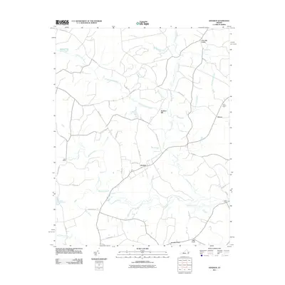
2011 Map of Dendron
USGS Topo · Published 2011About this map
Blackwater River and its intricate network of wetland drainages define this portion of the Virginia coastal plain. The landscape is dominated by named swamps such as Johnchecohunk Swamp, Cypress Swamp, and Dark Swamp, which dictate the winding paths of rural roads like Salisbury Rd and New Design Rd. The town of Dendron serves as the central hub of the quadrangle, situated south of Spratleys Mill and the headwaters of Milltail Creek. Historical land use is evident in the scattered settlements of Elberon and Lazy Oak Corner, while infrastructure like the Surry Lookout Tower and crossings at New Bridge and Walls Bridge highlight the region's managed timber and water resources. The confluence at Goodrich Fork and Ellis Fork in the southern reaches illustrates the complex hydrology that has historically influenced travel and agriculture throughout Surry County.
Find a feature on this map
40 named features on this map. Tap any name to fly to it.
Don’t see what you’re looking for? This feature index may not catch every label — zoom into the map to look around manually.
Map Details
Editions of this 2011 Dendron Map
This is the sole edition of this map. No revisions or reprints were ever made.
Other maps of this area

1919 · Surry
USGS Topo · 1:62,500

1919 · Disputanta
USGS Topo · 1:62,500

1919 · Homeville
USGS Topo · 1:48,000

1920 · Ivor
USGS Topo · 1:62,500

1920 · Homeville
USGS Topo · 1:62,500

1943 · Manry
USGS Topo · 1:31,680

1943 · Savedge
USGS Topo · 1:31,680

1943 · Richmond
USGS Topo · 1:250,000

1944 · Waverly
USGS Topo · 1:31,680

1944 · Ivor
USGS Topo · 1:24,000