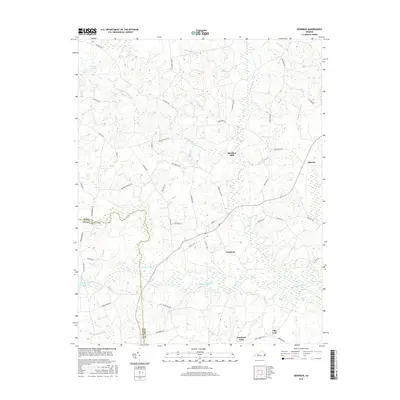
2016 Map of Dendron
USGS Topo · Published 2016About this map
Dendron and its surrounding wetlands occupy a landscape defined by the low-lying basins of the Blackwater River and its numerous swampy tributaries. The topography is dominated by an intricate network of drainages with distinctive names such as Johnchecohunk Swamp, Hollichecohunk Swamp, and Coppahaunk Swamp, illustrating the water-heavy nature of this coastal plain region. Settlement is concentrated along historical crossroads and near water sources, including the community of Elberon and the former site of Spratleys Mill. The map documents a rural corridor where the boundary between Surry County and Sussex County is marked by the river's winding course. Notable landmarks like the Cypress Pocosin and Atkins Pond highlight the unique ecological features that have shaped local land use and transportation routes like Salisbury Road and Carsley Road for generations.
Find a feature on this map
56 named features on this map. Tap any name to fly to it.
Don’t see what you’re looking for? This feature index may not catch every label — zoom into the map to look around manually.
Map Details
Editions of this 2016 Dendron Map
This is the sole edition of this map. No revisions or reprints were ever made.
Other maps of this area

1919 · Surry
USGS Topo · 1:62,500

1919 · Disputanta
USGS Topo · 1:62,500

1919 · Homeville
USGS Topo · 1:48,000

1920 · Ivor
USGS Topo · 1:62,500

1920 · Homeville
USGS Topo · 1:62,500

1943 · Manry
USGS Topo · 1:31,680

1943 · Savedge
USGS Topo · 1:31,680

1943 · Richmond
USGS Topo · 1:250,000

1944 · Waverly
USGS Topo · 1:31,680

1944 · Ivor
USGS Topo · 1:24,000