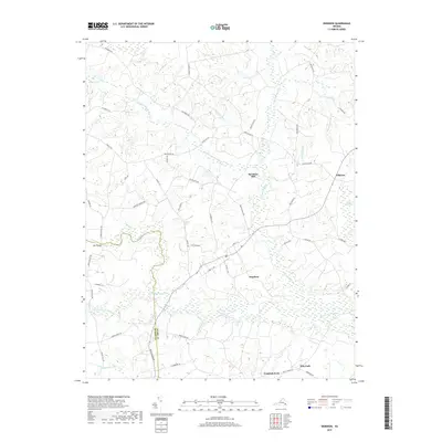
2019 Map of Dendron
USGS Topo · Published 2019About this map
Dendron serves as the central settlement in this portion of the Virginia Coastal Plain, where a intricate network of wetlands and minor tributaries define the rural landscape. The southern reaches are marked by the winding course of the Blackwater River, which draws from a vast system of named wetlands including Johnchecohunk Swamp, Coppohaunk Swamp, and Hazel Swamp. These swampy lowlands historically dictated the placement of roads and early industrial sites, such as Spratleys Mill near the center of the quadrangle. Small rural crossroads and communities like Elberon, Goodrich Fork, and Ellis Fork are linked by local routes such as State Rte 616 and Blackwater Rd. The map also captures the Surry Co / Sussex Co boundary line, providing a clear view of the regional geography as it appeared in the early twenty-first century.
Find a feature on this map
55 named features on this map. Tap any name to fly to it.
Don’t see what you’re looking for? This feature index may not catch every label — zoom into the map to look around manually.
Map Details
Editions of this 2019 Dendron Map
This is the sole edition of this map. No revisions or reprints were ever made.
Other maps of this area

1919 · Surry
USGS Topo · 1:62,500

1919 · Disputanta
USGS Topo · 1:62,500

1919 · Homeville
USGS Topo · 1:48,000

1920 · Ivor
USGS Topo · 1:62,500

1920 · Homeville
USGS Topo · 1:62,500

1943 · Manry
USGS Topo · 1:31,680

1943 · Savedge
USGS Topo · 1:31,680

1943 · Richmond
USGS Topo · 1:250,000

1944 · Waverly
USGS Topo · 1:31,680

1944 · Ivor
USGS Topo · 1:24,000