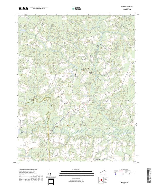
2022 Map of Dendron
USGS Topo · Published 2022About this map
Dendron and the surrounding Tidewater region are defined by an intricate network of wetlands and river drainage systems, prominently featuring the Blackwater River and several expansive swamps. The landscape's historical development is anchored by the settlement at Dendron, while smaller communities like Elberon and the crossroads at Goodrich Fork and Ellis Fork mark the transition from residential areas to the wilder pocosin and swampland. Local history is grounded in sites such as Springhill Cem and Spratleys Mill, which suggest the agricultural and industrial roots of this corner of Surry and Sussex counties.
Find a feature on this map
54 named features on this map. Tap any name to fly to it.
Don’t see what you’re looking for? This feature index may not catch every label — zoom into the map to look around manually.
Map Details
Editions of this 2022 Dendron Map
This is the sole edition of this map. No revisions or reprints were ever made.