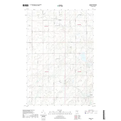
2019 Map of Denham
USGS Topo · Published 2019About this map
Denham and Rutledge anchor this portion of Pine County, situated along a landscape defined by the remnants of the rail era and a dense network of wetlands. The presence of Soo Line Rd tracing the former corridor of the Minneapolis, St. Paul and Sault Ste. Marie Railroad reflects the historical transport spine that once fueled these small timber and farming communities. In the southern reach, the Pine River meanders toward the settlement of Rutledge, passing near the Lakeview Cem and several water bodies including Cemetery Lake and Mud Lake. Local family and industrial history is evident in names like Old Creamery Rd and Faith Church Rd, while the northern portion is dominated by the drainage of Birch Creek and Birch Cr.
Find a feature on this map
59 named features on this map. Tap any name to fly to it.
Don’t see what you’re looking for? This feature index may not catch every label — zoom into the map to look around manually.
Map Details
Editions of this 2019 Denham Map
This is the sole edition of this map. No revisions or reprints were ever made.
Other maps of this area

1953 · Duluth
USGS Topo · 1:250,000

1958 · Duluth
USGS Topo · 1:250,000

1961 · Sandstone
USGS Topo · 1:62,500

1961 · Moose Lake
USGS Topo · 1:62,500

1968 · Giese
USGS Topo · 1:24,000

1969 · Arthyde
USGS Topo · 1:24,000

1969 · Ronald
USGS Topo · 1:24,000

1980 · Sandstone
USGS Topo · 1:100,000

1981 · Willow River
USGS Topo · 1:24,000

1981 · Kettle River
USGS Topo · 1:24,000