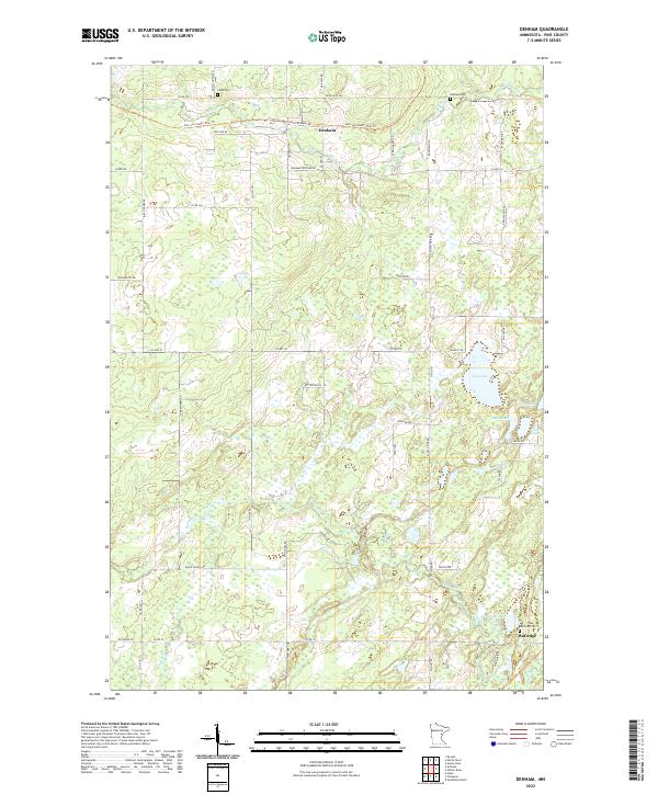
2022 Map of Denham
USGS Topo · Published 2022About this map
Denham and Rutledge serve as the primary anchors for this northern Pine County landscape, where the legacy of the railroad is prominently visible. The Soo Line Rd and the Soo Line South: Pine Trl cut across the northern terrain, tracing the path of former rail operations that once sustained the local economy. Much of the surrounding area is defined by a complex network of wetlands and water bodies, including the meandering Pine River, Fox Lake, and Birch Creek. For genealogists, the map identifies several significant burial sites such as Lakeview Cem near Rutledge, and both Faith Cem and Denham Cem to the north. These sites, alongside landmarks like Old Creamery Rd, reflect the early 20th-century settlement patterns of the region's agricultural and transit history.
Find a feature on this map
59 named features on this map. Tap any name to fly to it.
Don’t see what you’re looking for? This feature index may not catch every label — zoom into the map to look around manually.
Map Details
Editions of this 2022 Denham Map
This is the sole edition of this map. No revisions or reprints were ever made.
Other maps of this area

1953 · Duluth
USGS Topo · 1:250,000

1958 · Duluth
USGS Topo · 1:250,000

1961 · Sandstone
USGS Topo · 1:62,500

1961 · Moose Lake
USGS Topo · 1:62,500

1968 · Giese
USGS Topo · 1:24,000

1969 · Arthyde
USGS Topo · 1:24,000

1969 · Ronald
USGS Topo · 1:24,000

1980 · Sandstone
USGS Topo · 1:100,000

1981 · Willow River
USGS Topo · 1:24,000

1981 · Kettle River
USGS Topo · 1:24,000