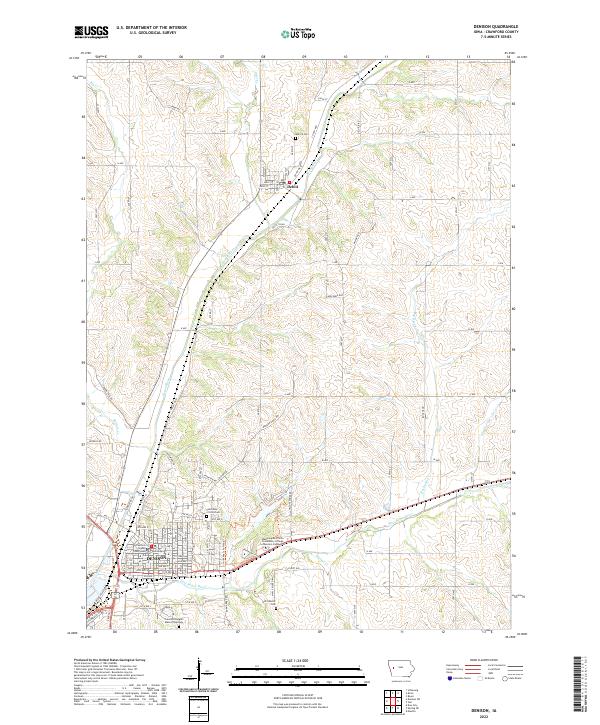
2022 Map of Denison
USGS Topo · Published 2022About this map
The confluence of the Boyer River and East Boyer River defines the landscape of this Crawford County region, where the city of Denison serves as a significant regional hub. As the county seat, the city is anchored by the Crawford County Courthouse and the Western Iowa Tech Community College Denison Campus. The settlement pattern follows the river valleys and the local rail lines, with the smaller community of Deloit situated to the north along the Boyer's banks. For genealogists and local historians, the map is a dense record of community landmarks, including several burial grounds such as Milford Cem, Saint Rose of Lima Cem, Old Catholic Cem, and Crawford Heights Memory Gardens. The surrounding terrain is dissected by numerous waterways including Walnut Creek, Rocky Run, and Buffalo Creek, illustrating the drainage patterns that shaped the early agricultural development and road networks of western Iowa.
Find a feature on this map
93 named features on this map. Tap any name to fly to it.
Don’t see what you’re looking for? This feature index may not catch every label — zoom into the map to look around manually.
Map Details
Editions of this 2022 Denison Map
This is the sole edition of this map. No revisions or reprints were ever made.
Other maps of this area

1954 · Omaha
USGS Topo · 1:250,000

1954 · Fort Dodge
USGS Topo · 1:250,000

1957 · Omaha
USGS Topo · 1:250,000

1957 · Fort Dodge
USGS Topo · 1:250,000

1958 · Omaha
USGS Topo · 1:250,000

1958 · Fort Dodge
USGS Topo · 1:250,000

1971 · Schleswig
USGS Topo · 1:24,000

1971 · Earling NE
USGS Topo · 1:24,000

1971 · Denison
USGS Topo · 1:24,000
1971 · Dow City
USGS Topo · 1:24,000