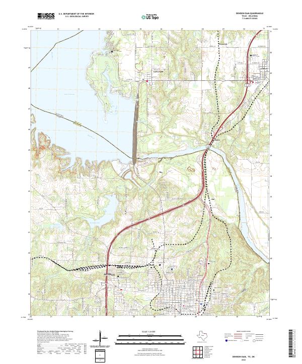
2022 Map of Denison Dam
USGS Topo · Published 2022About this map
The Red River forms a winding border between Grayson County, Texas, and Bryan County, Oklahoma, at a point dominated by the massive waters of Lake Texoma. This landscape is defined by the engineering of the Denison Dam Road, which separates the reservoir from the river's lower course. To the south, the city of Denison expands across the terrain, its residential grid reaching toward several established burial sites, including Fairview Cemetery and Oakwood Cemetery. The area's focus on recreation and natural preservation is evident through the Ike's Hike and Bike Trail and the Armadillo Hill Nature Trail located on the western bluffs. Smaller settlements like Cartwright and Colbert sit just across the state line in Oklahoma, connected by a network of local routes such as Franklin Drive and Butterfield Road.
Find a feature on this map
102 named features on this map. Tap any name to fly to it.
Don’t see what you’re looking for? This feature index may not catch every label — zoom into the map to look around manually.
Map Details
Editions of this 2022 Denison Dam Map
This is the sole edition of this map. No revisions or reprints were ever made.
Other maps of this area

1901 · Denison
USGS Topo · 1:125,000

1954 · Sherman
USGS Topo · 1:250,000

1957 · Denison Dam
USGS Topo · 1:24,000

1958 · Durant
USGS Topo · 1:62,500

1958 · Whitesright
USGS Topo · 1:62,500

1958 · Denison Dam
USGS Topo · 1:62,500

1958 · Sherman NW
USGS Topo · 1:24,000

1958 · Sherman
USGS Topo · 1:250,000

1958 · Sherman
USGS Topo · 1:62,500

1958 · Sherman
USGS Topo · 1:24,000