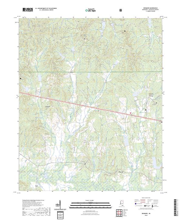
2024 Map of Denmark
USGS Topo · Published 2024About this map
The Yocona River bottomlands define the southern reaches of this Lafayette County landscape, where the small community of Tula sits near the confluence with Santy Creek. Moving north, the terrain transitions into the protected woodlands of the Holly Springs National Forest, a region marked by a dense network of tributaries including Kettle Creek, West Cypress Creek, and Wolf Creek. This area is characterized by scattered rural settlements and numerous local burial grounds that offer significant value for genealogical research, such as Springdale Cem, Cypress Cem, and Bluff Springs Cem. The settlement of Denmark serves as a central point along the local road network, while the northeastern corner is anchored by Lafayette Springs and its namesake Lafayette Springs Cem. This 2024 survey documents the enduring rural character of the region, where topographic highs like Liberty Hill overlook a landscape of small lakes and winding creek branches.
Find a feature on this map
56 named features on this map. Tap any name to fly to it.
Don’t see what you’re looking for? This feature index may not catch every label — zoom into the map to look around manually.
Map Details
Editions of this 2024 Denmark Map
This is the sole edition of this map. No revisions or reprints were ever made.
Other maps of this area

1942 · Denmark
USGS Topo · 1:62,500

1943 · Denmark
USGS Topo · 1:62,500

1949 · New Albany
USGS Topo · 1:62,500

1951 · New Albany
USGS Topo · 1:62,500

1956 · Tupelo
USGS Topo · 1:250,000

1958 · Tupelo
USGS Topo · 1:250,000

1972 · Paris
USGS Topo · 1:24,000

1972 · Randolph
USGS Topo · 1:24,000
1972 · Tula
USGS Topo · 1:24,000
1980 · Thaxton
USGS Topo · 1:24,000