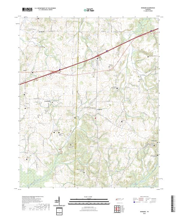
2022 Map of Denmark
USGS Topo · Published 2022About this map
The Haywood and Madison county line bisects this portion of West Tennessee, where small farming communities and historic church congregations anchor the landscape. The town of Denmark serves as a local focal point in the southeast, distinguished by its concentration of religious sites like the Denmark Southern Methodist Episcopal Church Cem and the Denmark Christian Methodist Episcopal Church Cem. The terrain is defined by a dense network of minor waterways, including Cypress Cr and Cane Cr, which likely influenced early settlement patterns in villages like Wellwood, Union, and Leighton.
Find a feature on this map
90 named features on this map. Tap any name to fly to it.
Don’t see what you’re looking for? This feature index may not catch every label — zoom into the map to look around manually.
Map Details
Editions of this 2022 Denmark Map
This is the sole edition of this map. No revisions or reprints were ever made.
Other maps of this area

1950 · Sunnyhill
USGS Topo · 1:24,000

1951 · Sunnyhill
USGS Topo · 1:24,000

1956 · Blytheville
USGS Topo · 1:250,000

1959 · Blytheville
USGS Topo · 1:250,000

1959 · Bells
USGS Topo · 1:24,000

1959 · Westover
USGS Topo · 1:24,000

1959 · Denmark
USGS Topo · 1:24,000

1959 · Adair
USGS Topo · 1:24,000

1959 · Hillville
USGS Topo · 1:24,000

1961 · Jones
USGS Topo · 1:24,000