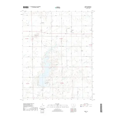
2018 Map of Dennis
USGS Topo · Published 2018About this map
Big Hill Lake dominates the central and southwestern portion of this Labette County landscape, where modern parkways like Mound Valley Pkwy and Timberhill Pkwy now wind around its irregular shoreline. The reservoir has transformed the local drainage, capturing the waters of Big Hill Cr and Wildcat Cr. To the north, the small settlement of Dennis sits at the intersection of Gray Rd and 24000 Rd, while the older landmarks of Twin Mounds and Bender Mounds rise above the surrounding plains. Genealogists will find interest in the well-preserved locations of Harmony Cem and Pleasant Hill Cem, which anchor the rural community. The map also documents the eastern reaches of the area, including the small locales of Fern and Grove, positioned near Little Labette Cr and Bachelor Cr.
Find a feature on this map
45 named features on this map. Tap any name to fly to it.
Don’t see what you’re looking for? This feature index may not catch every label — zoom into the map to look around manually.
Map Details
Editions of this 2018 Dennis Map
This is the sole edition of this map. No revisions or reprints were ever made.
Other maps of this area

1886 · Independence
USGS Topo · 1:125,000

1886 · Parsons
USGS Topo · 1:125,000

1893 · Parsons
USGS Topo · 1:125,000

1894 · Independence
USGS Topo · 1:125,000

1905 · Independence
USGS Topo · 1:125,000

1945 · Parsons
USGS Topo · 1:62,500

1946 · Parsons
USGS Topo · 1:62,500

1946 · Mound Valley
USGS Topo · 1:62,500

1947 · Parsons
USGS Topo · 1:62,500

1947 · Joplin
USGS Topo · 1:250,000