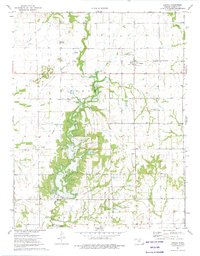
1973 Map of Dennis
USGS Topo · Published 1975About this map
Big Hill Dam and the emerging Big Hill Lake dominate the southwestern landscape of this Labette County survey. The construction project signifies a major shift for the local environment, transforming the Big Hill Creek valley into a large reservoir. To the north, the terrain is marked by distinctive natural landmarks like Twin Mounds and Bender Mounds, the latter of which sits atop the active Bender Oil Field. The community of Dennis serves as a central hub, situated along the St Louis-San Francisco railroad line which cuts east-to-west across the map. Local heritage is preserved through landmarks such as Harmony Cem, Zion Ch, and the small settlement of Maddy. The southeastern portion of the map transitions into the Big Hill State Game Management Area, highlighting the region's balance between industrial extraction, infrastructure development, and conservation during the mid-1970s.
Find a feature on this map
30 named features on this map. Tap any name to fly to it.
Don’t see what you’re looking for? This feature index may not catch every label — zoom into the map to look around manually.
Map Details
Editions of this 1973 Dennis Map
This is the sole edition of this map. No revisions or reprints were ever made.
Other maps of this area

1886 · Independence
USGS Topo · 1:125,000

1886 · Parsons
USGS Topo · 1:125,000

1893 · Parsons
USGS Topo · 1:125,000

1894 · Independence
USGS Topo · 1:125,000

1905 · Independence
USGS Topo · 1:125,000

1945 · Parsons
USGS Topo · 1:62,500

1946 · Parsons
USGS Topo · 1:62,500

1946 · Mound Valley
USGS Topo · 1:62,500

1947 · Parsons
USGS Topo · 1:62,500

1947 · Joplin
USGS Topo · 1:250,000