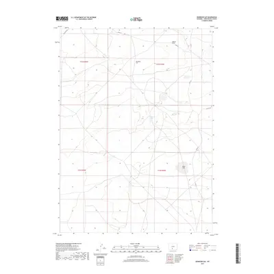
2017 Map of Dennison Cap
USGS Topo · Published 2017About this map
Siberia Ridge and the prominent high ground of Dennison Cap dominate this high-desert landscape in Sweetwater County. The terrain is characterized by expansive drainage patterns and remote seasonal water features such as Twelvemile Hole and Black Lake. A sparse network of unpaved tracks, including Red Desert Rd, Luman Rd, and Co Rd 23, provides the only access through these expansive townships. This 2017 survey reflects the enduring character of Wyoming’s Red Desert region, where the Public Land Survey System grid serves as the primary framework for navigation. The absence of permanent settlements or significant industrial footprints emphasizes the area's role as open rangeland or protected public space during the early 21st century.
Find a feature on this map
12 named features on this map. Tap any name to fly to it.
Don’t see what you’re looking for? This feature index may not catch every label — zoom into the map to look around manually.
Map Details
Editions of this 2017 Dennison Cap Map
This is the sole edition of this map. No revisions or reprints were ever made.
Other maps of this area

1954 · Rawlins
USGS Topo · 1:250,000

1954 · Rock Springs
USGS Topo · 1:250,000

1958 · Rawlins
USGS Topo · 1:250,000

1958 · Rock Springs
USGS Topo · 1:250,000

1960 · Lost Creek Butte
USGS Topo · 1:62,500

1960 · Hansen Lake
USGS Topo · 1:24,000

1962 · Rawlins
USGS Topo · 1:250,000

1962 · Rock Springs
USGS Topo · 1:250,000

1966 · Wamsutter
USGS Topo · 1:24,000

1966 · Monument Lake
USGS Topo · 1:24,000