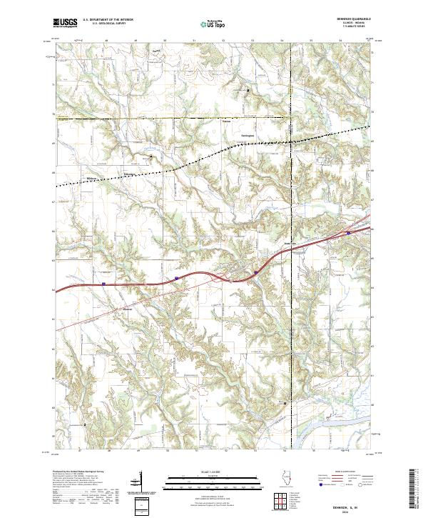
2024 Map of Dennison
USGS Topo · Published 2024About this map
Dennison and Weaver sit within a landscape defined by the intersection of early transport routes and the winding tributaries of the Wabash River. This modern survey details the persistent rural settlement patterns of Clark County, where the historic Old National Hwy and US Hwy 40 parallel the CSX Transportation railroad line. The map highlights numerous local family-named sites, including Cummings Cem near Farrington and Farris Cem south of Patton. A dense network of creeks, such as Clear Creek, Crooked Creek, and Sugar Creek, carves through the terrain, illustrating the natural drainage patterns that have shaped agricultural boundaries for generations. The border between Illinois and Indiana runs vertically through the eastern portion of the sheet, dividing small communities like State Line and marking the administrative shift across the river valley.
Find a feature on this map
70 named features on this map. Tap any name to fly to it.
Don’t see what you’re looking for? This feature index may not catch every label — zoom into the map to look around manually.
Map Details
Editions of this 2024 Dennison Map
This is the sole edition of this map. No revisions or reprints were ever made.
Other maps of this area

1932 · Marshall
USGS Topo · 1:62,500

1937 · Marshall
USGS Topo · 1:62,500

1940 · Pimento
USGS Topo · 1:24,000

1941 · Terre Haute
USGS Topo · 1:24,000

1942 · Hutton
USGS Topo · 1:24,000

1942 · Dennison
USGS Topo · 1:24,000

1947 · Paris
USGS Topo · 1:62,500

1948 · Terre Haute
USGS Topo · 1:24,000

1949 · Paris
USGS Topo · 1:62,500

1950 · New Goshen
USGS Topo · 1:24,000