Loading...
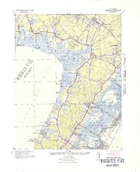
Loading map...1894 Map of Dennisville
USGS Topo · Published 1922About this map
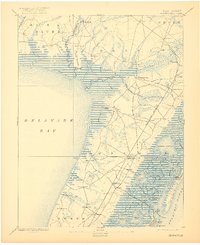
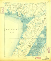
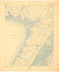
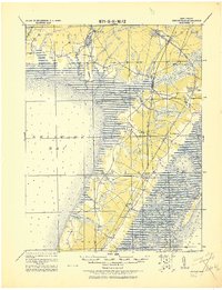
The coastal wetlands and maritime corridors of Cape May County are documented here in a late 19th-century survey. The landscape is defined by the massive Great Cedar Swamp and Timber and Beaver Swamp, which separate the inland settlements from the Atlantic coast. The West Jersey Railroad serves as the primary spine of transportation, connecting towns like Dennisville and South Dennisville to more remote coastal points.
Find a feature on this map
86 named features on this map. Tap any name to fly to it.
Don’t see what you’re looking for? This feature index may not catch every label — zoom into the map to look around manually.
Map Details
Date Portrayed1894
Date Published1922
PublisherU.S. Geological Survey
Map TypeTopographic
Scale1:62,500
Physical Dimensions16.52 x 20.27 inches
Editions of this 1894 Dennisville Map
4 editions found

Historical Maps of Lower Township Through Time
4 maps found

Featured Locations
- Upper Township, NJ
- Lower Township, NJ
- Middle Township, NJ
- Maurice River Township, NJ
- Villas, Lower Township
Source Details
SourceU.S. Geological Survey
CopyrightPublic Domain