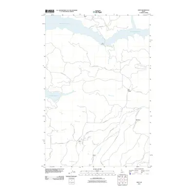
2011 Map of Dent
USGS Topo · Published 2011About this map
Dworshak Reservoir dominates the northern landscape of this Clearwater County area, where the massive Dent Bridge spans the water near the settlement of Dent. The terrain is defined by a series of steep benches and creek drainages, including Whiskey Creek, Canyon Creek, and Indian Creek. Family names and local history are preserved in the road network and landmarks, such as Wells Bench Rd and the Huckleberry Butte area. Genealogists will find the Wells Cemetery and Weseman Cemetery situated among the high ridges, while smaller locales like Best Corner and Hansberg mark intersections of rural travel. The map illustrates a region where timber and topography have long shaped human movement, from the winding path of Elk River Rd to the more isolated stretches of Loseth Rd and Grangemont Rd.
Find a feature on this map
30 named features on this map. Tap any name to fly to it.
Don’t see what you’re looking for? This feature index may not catch every label — zoom into the map to look around manually.
Map Details
Editions of this 2011 Dent Map
This is the sole edition of this map. No revisions or reprints were ever made.
Other maps of this area

1924 · Kamiah
USGS Topo · 1:125,000

1955 · Pullman
USGS Topo · 1:250,000

1958 · Pullman
USGS Topo · 1:250,000

1961 · Ahsahka
USGS Topo · 1:62,500

1967 · Rudo
USGS Topo · 1:24,000

1967 · Orofino West
USGS Topo · 1:24,000

1967 · Orofino East
USGS Topo · 1:24,000

1969 · Elk Creek Falls
USGS Topo · 1:24,000
1969 · Grangemont
USGS Topo · 1:24,000
1969 · Dent
USGS Topo · 1:24,000