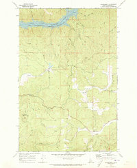
1969 Map of Grangemont
USGS Topo · Published 1973About this map
Grangemont serves as the primary point of settlement in this Clearwater County landscape, appearing here as it was surveyed in the late 1960s. The northern portion of the map is dominated by the North Fork Clearwater River Dworshak Reservoir, a significant water body at an elevation of 1600 feet. This reservoir, fed by numerous tributaries such as O'Neil Creek and Hudson Creek, illustrates the impact of large-scale water management on the Idaho terrain during this period.
Find a feature on this map
17 named features on this map. Tap any name to fly to it.
Don’t see what you’re looking for? This feature index may not catch every label — zoom into the map to look around manually.
Map Details
Editions of this 1969 Grangemont Map
3 editions found
Other maps of this area

1923 · Washington Creek
USGS Topo · 1:125,000

1924 · Kamiah
USGS Topo · 1:125,000

1924 · Weippe
USGS Topo · 1:125,000

1938 · Headquarters
USGS Topo · 1:48,000

1944 · Headquarters
USGS Topo · 1:62,500

1955 · Pullman
USGS Topo · 1:250,000

1956 · Hamilton
USGS Topo · 1:250,000

1958 · Pullman
USGS Topo · 1:250,000

1959 · Hamilton
USGS Topo · 1:250,000

1960 · Hamilton
USGS Topo · 1:250,000