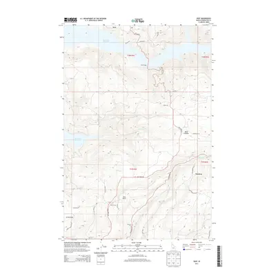
2013 Map of Dent
USGS Topo · Published 2013About this map
Dworshak Reservoir dominates the northwestern portion of this Clearwater County landscape, where the inundated river canyon meets steep Idaho timberlands. The settlement of Dent is situated near the northern shoreline, connected to the southern hills by the significant engineering of the Dent Bridge. Higher elevations to the south and east are defined by timbered plateaus and small rural clusters such as Best Corner and Hansberg. Family and local history are preserved at the Wells Cem on Wells Bench and the Weseman Cem further south near Whiskey Cr. The road network, including Elk River Rd and Grangemont Rd, follows the difficult topography around Huckleberry Butte and Eureka Ridge, illustrating how the modern reservoir transformed travel patterns in this region of the Clearwater National Forest vicinity.
Find a feature on this map
39 named features on this map. Tap any name to fly to it.
Don’t see what you’re looking for? This feature index may not catch every label — zoom into the map to look around manually.
Map Details
Editions of this 2013 Dent Map
This is the sole edition of this map. No revisions or reprints were ever made.
Other maps of this area

1924 · Kamiah
USGS Topo · 1:125,000

1955 · Pullman
USGS Topo · 1:250,000

1958 · Pullman
USGS Topo · 1:250,000

1961 · Ahsahka
USGS Topo · 1:62,500

1967 · Rudo
USGS Topo · 1:24,000

1967 · Orofino West
USGS Topo · 1:24,000

1967 · Orofino East
USGS Topo · 1:24,000

1969 · Elk Creek Falls
USGS Topo · 1:24,000
1969 · Grangemont
USGS Topo · 1:24,000
1969 · Dent
USGS Topo · 1:24,000