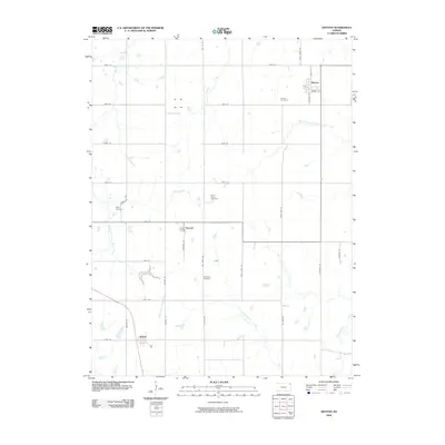
2009 Map of Denton
USGS Topo · Published 2009About this map
Agricultural lands in Doniphan County are defined by a network of drainage systems and small rural settlements in the early 21st century. The town of Denton serves as a local hub, with its grid-style streets including Oak St, Maple Ave, and Ashland St radiating from the center. Smaller clusters such as Purcell and Huron anchor the surrounding countryside, while several burial sites like Denton Cemetery and Saint Marys Cemetery provide significant points of interest for genealogists tracing local family histories.
Find a feature on this map
42 named features on this map. Tap any name to fly to it.
Don’t see what you’re looking for? This feature index may not catch every label — zoom into the map to look around manually.
Map Details
Editions of this 2009 Denton Map
This is the sole edition of this map. No revisions or reprints were ever made.
Other maps of this area

1885 · Atchison
USGS Topo · 1:125,000

1888 · Atchison
USGS Topo · 1:125,000

1893 · Atchison
USGS Topo · 1:125,000

1926 · Atchison
USGS Topo · 1:62,500

1926 · Oregon
USGS Topo · 1:62,500

1950 · Kansas City
USGS Topo · 1:250,000

1954 · Kansas City
USGS Topo · 1:250,000

1956 · Kansas City
USGS Topo · 1:250,000
1959 · Sparks
USGS Topo · 1:24,000
1959 · Bendena
USGS Topo · 1:24,000