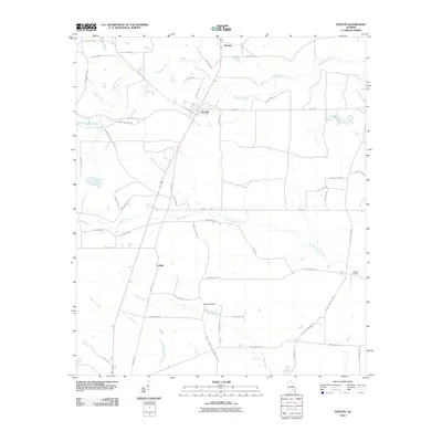
2011 Map of Denton
USGS Topo · Published 2011About this map
Denton serves as the central hub of this South Georgia landscape, where a grid of rural roads connects agricultural homesteads and small settlements. The town’s position is marked by the intersection of W Georgia Ave and County Rd-320, while smaller locales like Brooker to the north and Lehigh to the southwest delineate the surrounding community. This region is defined by a dense network of black-water drainages, including the winding paths of Little Hurricane Creek and Town Creek, which carve through the coastal plain. Genealogists and local historians will find significant value in the documentation of family-linked sites such as Wilcox Cemetery and Burkett Cemetery. The naming conventions of the road system, from Jms Anderson Rd to Curtis Spires Rd, reflect the deep-rooted family histories that have shaped this portion of Jeff Davis County.
Find a feature on this map
60 named features on this map. Tap any name to fly to it.
Don’t see what you’re looking for? This feature index may not catch every label — zoom into the map to look around manually.
Map Details
Editions of this 2011 Denton Map
This is the sole edition of this map. No revisions or reprints were ever made.
Other maps of this area

1953 · Waycross
USGS Topo · 1:250,000

1958 · Waycross
USGS Topo · 1:250,000

1971 · Douglas North
USGS Topo · 1:24,000

1971 · Nicholls NE
USGS Topo · 1:24,000

1971 · Nicholls
USGS Topo · 1:24,000

1971 · Roper
USGS Topo · 1:24,000

1971 · Snipesville
USGS Topo · 1:24,000

1971 · Broxton NE
USGS Topo · 1:24,000

1971 · Hazlehurst South
USGS Topo · 1:24,000

1971 · Sessoms
USGS Topo · 1:24,000