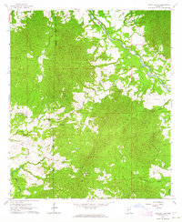
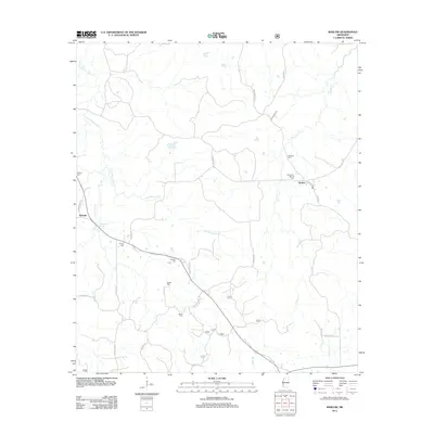
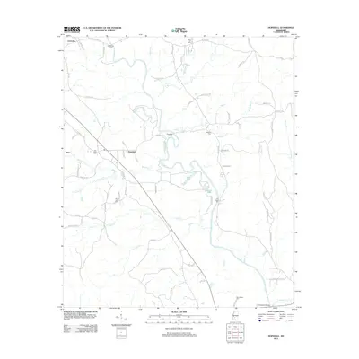
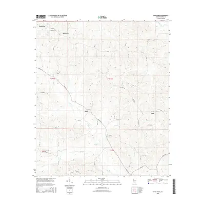
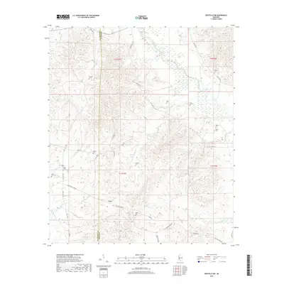
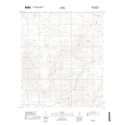
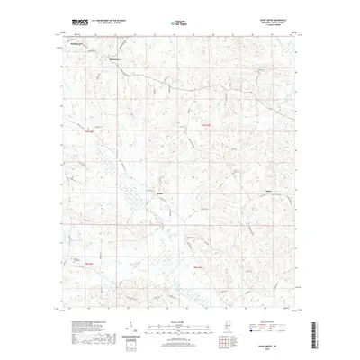
1963 Map of Dentville NW
USGS Topo · Published 1964About this map
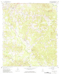
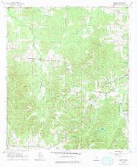
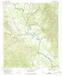
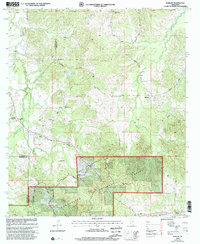
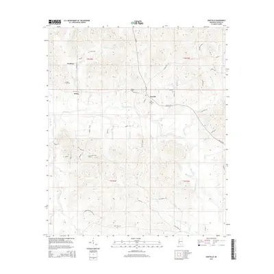
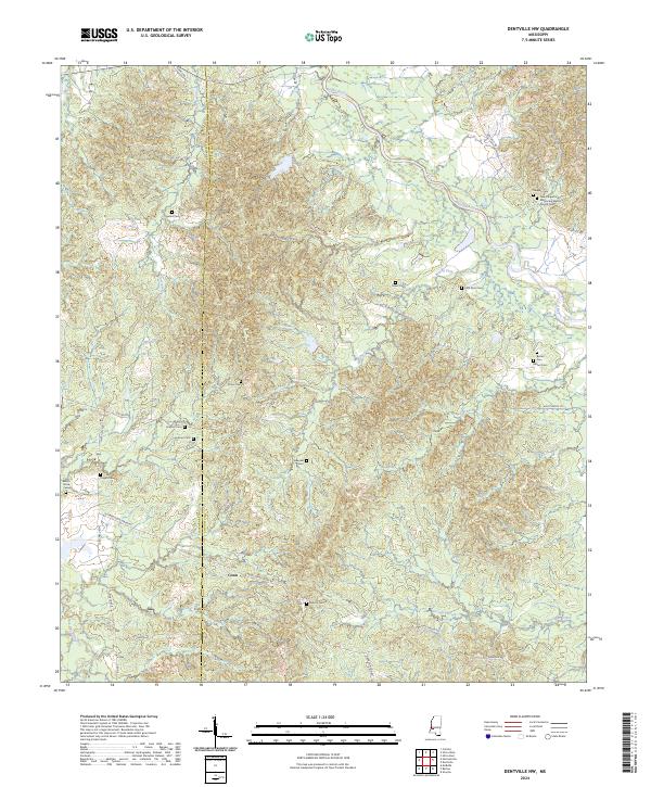
The Old Indian Treaty Boundary slices vertically through this rural landscape on the border of Claiborne and Copiah Counties, marking a significant historical line of demarcation. In the early 1960s, this area remained dominated by dense woodland and winding watercourses, most notably Bayou Pierre and its tributaries like Bell Branch. The settlement pattern is sparse, defined primarily by small family and community hubs like Meadows Store and a network of country churches including Chapel Hill Church and St Phillip Church. For genealogists, the map is remarkably dense with burial sites, featuring named locations such as Nelson Cem, Grant Cem, and Hulbert Cem. The landscape also reflects local industry through several Gravel Pits concentrated near the river bends, while the intricate network of secondary roads and field lines connects these isolated communities and farmsteads.
Find a feature on this map
24 named features on this map. Tap any name to fly to it.
Don’t see what you’re looking for? This feature index may not catch every label — zoom into the map to look around manually.
Map Details
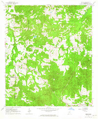
Editions of this 1963 Dentville NW Map
This is the sole edition of this map. No revisions or reprints were ever made.
Historical Maps of Conn Through Time
43 maps found
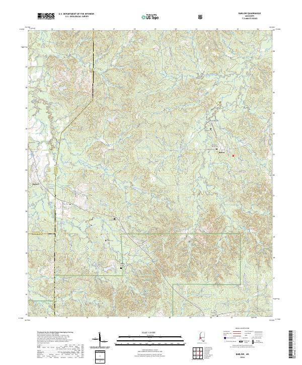
1963 Barlow
Copiah County, MS
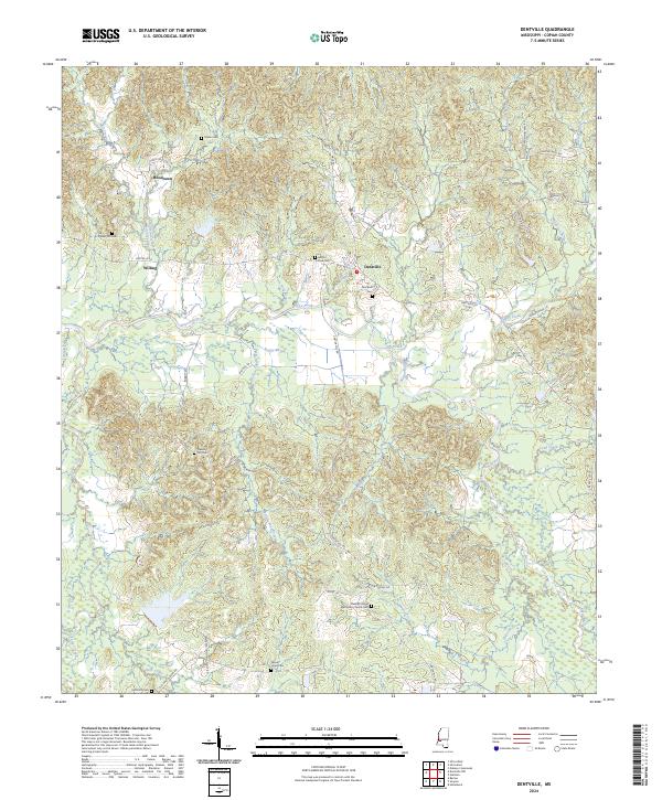
1963 Dentville
Copiah County, MS
1963 Dentville NW
Copiah County, MS
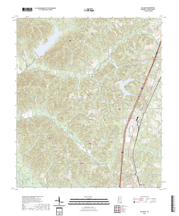
1963 Gallman
Copiah County, MS
1963 Shady Grove
Copiah County, MS
1963 Smyrna
Copiah County, MS
1970 Hopewell
Copiah County, MS
2000 Barlow
Copiah County, MS
2012 Barlow
Copiah County, MS
2012 Dentville
Copiah County, MS
2012 Dentville NW
Copiah County, MS
2012 Gallman
Copiah County, MS
2012 Hopewell
Copiah County, MS
2012 Shady Grove
Copiah County, MS
2012 Smyrna
Copiah County, MS
2015 Barlow
Copiah County, MS
2015 Dentville
Copiah County, MS
2015 Dentville NW
Copiah County, MS
2015 Gallman
Copiah County, MS
2015 Hopewell
Copiah County, MS
2015 Shady Grove
Copiah County, MS
2015 Smyrna
Copiah County, MS
2018 Barlow
Copiah County, MS
2018 Dentville
Copiah County, MS
2018 Dentville NW
Copiah County, MS
2018 Gallman
Copiah County, MS
2018 Hopewell
Copiah County, MS
2018 Shady Grove
Copiah County, MS
2018 Smyrna
Copiah County, MS
2020 Dentville
Copiah County, MS
2020 Gallman
Copiah County, MS
2020 Hopewell
Copiah County, MS
2020 Shady Grove
Copiah County, MS
2020 Smyrna
Copiah County, MS
2021 Barlow
Copiah County, MS
2021 Dentville NW
Copiah County, MS
2024 Barlow
Copiah County, MS
2024 Dentville
Copiah County, MS
2024 Dentville NW
Copiah County, MS
2024 Gallman
Copiah County, MS
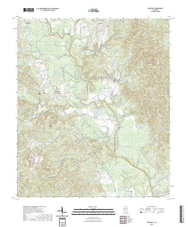
2024 Hopewell
Copiah County, MS
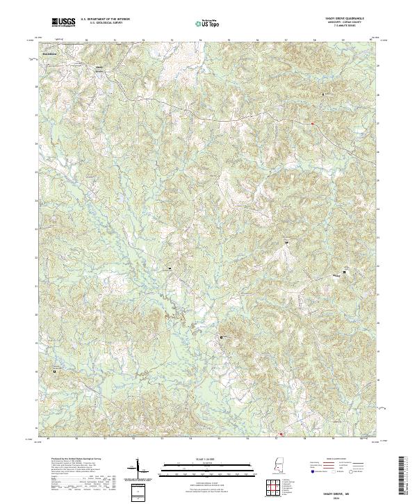
2024 Shady Grove
Copiah County, MS
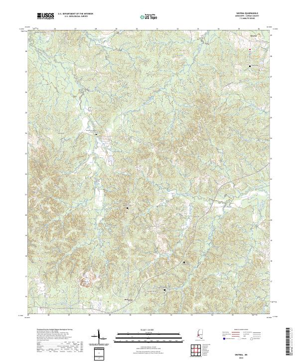
2024 Smyrna
Copiah County, MS