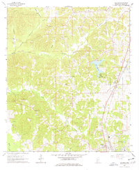
1963 Map of Gallman
USGS Topo · Published 1978About this map
The Illinois Central railroad serves as the primary corridor through this section of Copiah County, anchoring the community of Gallman. This 1963 field-checked survey reveals a rural landscape defined by numerous country churches and family cemeteries, suggesting a deeply rooted local genealogy. Small settlements and crossroads such as Tillman are interspersed between the drainages of Copiah Creek and Turkey Creek. The presence of several gravel pits indicates the local extractive industry of the era, while Lake Copiah and Camp Wesley Pines highlight the area's recreational and social hubs. From the Wiltshire-King Cem to Damascus Ch, the map provides a precise look at the distribution of community landmarks before the expansion of modern infrastructure in the latter half of the twentieth century.
Find a feature on this map
56 named features on this map. Tap any name to fly to it.
Don’t see what you’re looking for? This feature index may not catch every label — zoom into the map to look around manually.
Map Details
Editions of this 1963 Gallman Map
3 editions found
Other maps of this area

1903 · Jackson
USGS Topo · 1:125,000

1937 · Terry
USGS Topo · 1:48,000

1943 · Terry
USGS Topo · 1:62,500

1953 · Natchez
USGS Topo · 1:250,000

1955 · Jackson
USGS Topo · 1:250,000

1956 · Natchez
USGS Topo · 1:250,000

1959 · Natchez
USGS Topo · 1:250,000

1961 · Jackson
USGS Topo · 1:250,000

1962 · Jackson
USGS Topo · 1:250,000

1963 · Dentville
USGS Topo · 1:24,000