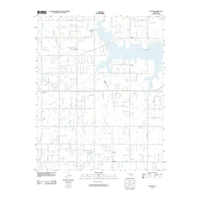
2010 Map of Denver
USGS Topo · Published 2010About this map
Denver and the sprawling waters of the Little River anchor this 2010 survey of the area east of Norman. The landscape is defined by a dense network of water management features, including the Oknoname 02722 Reservoir and Oknoname 02723 Reservoir, which regulate the flow of numerous local drainages. Local genealogists will find significant value in the documentation of historic burying grounds, such as Independence Cemetery and Denver Cemetery, alongside the small settlement of Maguire to the south. The suburban and rural transition is evident through the named road grid, featuring Alameda Dr and Etowah Rd, while aviation history is represented by the Pata Skyhaven Airport. The presence of several named streams like Dave Blue Creek and Dripping Springs Creek reveals the complex hydrologic character of the Oklahoma plains as they appeared at the start of the decade.
Find a feature on this map
38 named features on this map. Tap any name to fly to it.
Don’t see what you’re looking for? This feature index may not catch every label — zoom into the map to look around manually.
Map Details
Editions of this 2010 Denver Map
This is the sole edition of this map. No revisions or reprints were ever made.
Other maps of this area

1892 · Moore
USGS Topo · 1:62,500

1893 · Norman
USGS Topo · 1:62,500

1898 · Purcell
USGS Topo · 1:125,000

1910 · McComb
USGS Topo · 1:62,500

1925 · Norman NO 2
USGS Topo · 1:24,000

1930 · McLoud
USGS Topo · 1:62,500

1934 · Moore
USGS Topo · 1:62,500

1936 · Norman
USGS Topo · 1:62,500

1938 · Moore
USGS Topo · 1:62,500

1954 · Oklahoma City
USGS Topo · 1:250,000