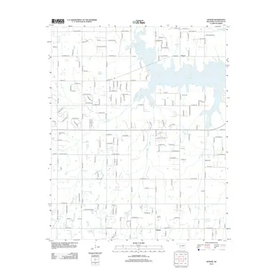
2012 Map of Denver
USGS Topo · Published 2012About this map
Lake Thunderbird dominates the eastern landscape of this Cleveland County region, its winding shoreline and numerous inlets creating a complex aquatic boundary. The settlement of Denver sits just north of the lake's primary body, while the community of Maguire occupies the southern reaches of the map. This area is defined by a transitional landscape where the suburban expansion of Norman meets established rural homesteads, evidenced by the dense grid of residential roads like Alameda Dr and E Lindsey St contrasted with larger undeveloped tracts. Significant local history is preserved in several burial grounds, including Falls Cem and Denver Cem. The hydrology is particularly intricate here, as the Little River feeds into the lake, joined by tributaries such as Dave Blue Cr and Clear Cr. Elevation shifts are subtle but notable at landmarks like Ft Hill in the southwest.
Find a feature on this map
119 named features on this map. Tap any name to fly to it.
Don’t see what you’re looking for? This feature index may not catch every label — zoom into the map to look around manually.
Map Details
Editions of this 2012 Denver Map
This is the sole edition of this map. No revisions or reprints were ever made.
Other maps of this area

1892 · Moore
USGS Topo · 1:62,500

1893 · Norman
USGS Topo · 1:62,500

1898 · Purcell
USGS Topo · 1:125,000

1910 · McComb
USGS Topo · 1:62,500

1925 · Norman NO 2
USGS Topo · 1:24,000

1930 · McLoud
USGS Topo · 1:62,500

1934 · Moore
USGS Topo · 1:62,500

1936 · Norman
USGS Topo · 1:62,500

1938 · Moore
USGS Topo · 1:62,500

1954 · Oklahoma City
USGS Topo · 1:250,000