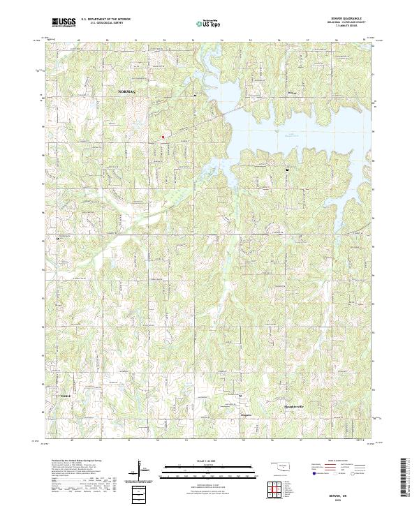
2022 Map of Denver
USGS Topo · Published 2022About this map
Lake Thunderbird dominates the landscape of eastern Cleveland County, serving as a focal point for the surrounding rural and residential communities. This modern survey illustrates the eastern edges of Norman and Noble, where suburban expansion meets the dense creek networks of the Little River valley. To the south and east, smaller settlements like Denver, Slaughterville, and Maguire maintain a more dispersed character, interspersed with small reservoirs such as 02723 Reservoir and 02721 Reservoir. The terrain is defined by its many drainages, including Dave Blue Cr, Jim Blue Cr, and Chouteau Cr, which carve through the land near landmarks like Ft Hill. For those researching local heritage, the map identifies several historic burial sites, including Falls Cem, Denver Cem, Fairview Cem, and Independence Cem, providing clear geographic context for family names and early community centers in this region.
Find a feature on this map
78 named features on this map. Tap any name to fly to it.
Don’t see what you’re looking for? This feature index may not catch every label — zoom into the map to look around manually.
Map Details
Editions of this 2022 Denver Map
This is the sole edition of this map. No revisions or reprints were ever made.
Other maps of this area

1892 · Moore
USGS Topo · 1:62,500

1893 · Norman
USGS Topo · 1:62,500

1898 · Purcell
USGS Topo · 1:125,000

1910 · McComb
USGS Topo · 1:62,500

1925 · Norman NO 2
USGS Topo · 1:24,000

1930 · McLoud
USGS Topo · 1:62,500

1934 · Moore
USGS Topo · 1:62,500

1936 · Norman
USGS Topo · 1:62,500

1938 · Moore
USGS Topo · 1:62,500

1954 · Oklahoma City
USGS Topo · 1:250,000