
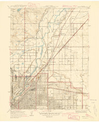
1940 Map of Derby
USGS Topo · Published 1940About this map
The industrial and agricultural fringes of north Denver are captured here just before the massive post-war expansion. The landscape is defined by the South Platte River and its intricate network of irrigation channels like the Fulton Ditch and O'Brien Ditch, which supported the truck farms surrounding Welby and Adams City. Near the river, the Stockyards and Sewage Disposal works signify the area's heavy utility role, while the massive Denver City and Co Airport and the neighboring Municipal Airport dominate the eastern plains.
Find a feature on this map
57 named features on this map. Tap any name to fly to it.
Don’t see what you’re looking for? This feature index may not catch every label — zoom into the map to look around manually.
Map Details
Editions of this 1940 Derby Map
2 editions found
Other maps of this area

1890 · East Denver
USGS Topo · 1:125,000

1899 · West Denver
USGS Topo · 1:125,000

1935 · East Denver Nos. 3 and 4
USGS Topo · 1:48,000

1938 · Derby
USGS Topo · 1:24,000

1938 · Long Branch
USGS Topo · 1:24,000

1940 · Brighton
USGS Topo · 1:31,680

1940 · Englewood
USGS Topo · 1:31,680

1940 · Eastlake
USGS Topo · 1:31,680

1940 · Lafayette
USGS Topo · 1:31,680

1941 · Long Branch
USGS Topo · 1:31,680