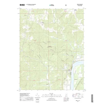
2019 Map of Derby
USGS Topo · Published 2019About this map
Leopold and Derby anchor this landscape along the north bank of the Ohio River in Perry County. The terrain is defined by a dense network of ridges and hollows within the Hoosier National Forest, where historical travel is traced through the Mogan Ridge trail system, including Mogan Ridge W Trail 1 and Mogan Ridge E Trail 1. Small settlements like Gerald and Chenault sit across the state line from one another, connected by the proximity of the river.
Find a feature on this map
69 named features on this map. Tap any name to fly to it.
Don’t see what you’re looking for? This feature index may not catch every label — zoom into the map to look around manually.
Map Details
Editions of this 2019 Derby Map
This is the sole edition of this map. No revisions or reprints were ever made.
Other maps of this area

1928 · Hardinsburg
USGS Topo · 1:48,000

1931 · Hardinsburg
USGS Topo · 1:62,500

1934 · Cannelton
USGS Topo · 1:62,500

1947 · Lodiburg
USGS Topo · 1:24,000

1947 · Hardinsburg
USGS Topo · 1:62,500

1949 · Cannelton
USGS Topo · 1:24,000

1950 · Beechwood
USGS Topo · 1:24,000

1950 · Alton
USGS Topo · 1:62,500

1950 · Alton
USGS Topo · 1:24,000

1951 · Alton
USGS Topo · 1:24,000