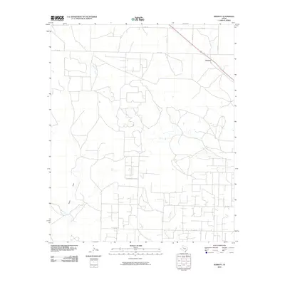
2010 Map of Dermott
USGS Topo · Published 2010About this map
Dermott sits at the intersection of a sprawling road network in Scurry County, where the plains are etched by a series of intermittent watercourses. The landscape is defined by the drainages of Deep Creek and Bluff Creek, which carve subtle paths through the terrain. This 2010 survey illustrates a rural environment primarily organized around county routes and local tracks like Tate Trl, reflecting the agricultural and ranching foundations of the region. To the southwest, the geography is marked by Mooar Draw and Mooar Creek, showing the natural drainage patterns that have long dictated movement and settlement in this part of West Texas. The grid-like precision of roads such as Co Rd 254 and N Co Rd 261 highlights how modern land division has overlaid the natural contours of the creeks.
Find a feature on this map
17 named features on this map. Tap any name to fly to it.
Don’t see what you’re looking for? This feature index may not catch every label — zoom into the map to look around manually.
Map Details
Editions of this 2010 Dermott Map
This is the sole edition of this map. No revisions or reprints were ever made.
Other maps of this area

1951 · Ira NW
USGS Topo · 1:24,000

1952 · Snyder
USGS Topo · 1:24,000

1952 · Ira NE
USGS Topo · 1:24,000

1954 · Dermott
USGS Topo · 1:24,000

1954 · Brand
USGS Topo · 1:24,000

1954 · Big Spring
USGS Topo · 1:250,000

1958 · Big Spring
USGS Topo · 1:250,000

1969 · Arah
USGS Topo · 1:24,000

1969 · Fluvanna
USGS Topo · 1:24,000

1969 · Flat Top Mountain
USGS Topo · 1:24,000