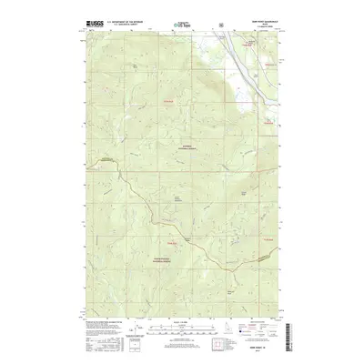
2017 Map of Derr Point
USGS Topo · Published 2017About this map
Coeur d'Alene National Forest and Kaniksu National Forest converge in this high-altitude landscape of northern Idaho. The terrain is defined by the sharp elevations of the Coeur d'Alene Mountains, where peaks like Whitetail Peak and Larch Mountain overlook a complex system of drainages including Derr Creek and Delyle Creek. Prominent ridges, such as Mosquito Ridge and Delyle Ridge, partition the landscape between the Clark Fork and the S Fork Coeur d'Alene River. This area serves as a critical corridor for forest management and local transport, evidenced by a network of forest roads including Nat For Dev Rd 332 and Clark Fork Rd. Human presence is marked by high-altitude landing strips like Riverlake Airport and Tuka Airport, alongside geological landmarks such as Derr Point and the Buckskin Saddle.
Find a feature on this map
44 named features on this map. Tap any name to fly to it.
Don’t see what you’re looking for? This feature index may not catch every label — zoom into the map to look around manually.
Map Details
Editions of this 2017 Derr Point Map
This is the sole edition of this map. No revisions or reprints were ever made.
Other maps of this area

1909 · Cataldo
USGS Topo · 1:125,000

1911 · Cataldo
USGS Topo · 1:125,000

1911 · Priest Lake
USGS Topo · 1:250,000

1913 · Priest Lake
USGS Topo · 1:250,000

1949 · Packsaddle Mtn
USGS Topo · 1:62,500

1951 · Packsaddle Mtn
USGS Topo · 1:62,500

1951 · Clark Fork
USGS Topo · 1:62,500

1955 · Spokane
USGS Topo · 1:250,000

1958 · Spokane
USGS Topo · 1:250,000

1958 · Sandpoint
USGS Topo · 1:250,000