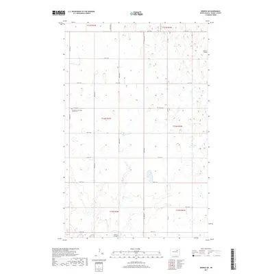
2017 Map of Derrick SW
USGS Topo · Published 2017About this map
Scandinavian Norwegian Lutheran Cem stands as a quiet focal point in this section of Ramsey County, reflecting the deep Scandinavian heritage that shaped the region's early settlement. The landscape is defined by the winding course of Edmore Coulee, which meanders across the prairie terrain, influencing the layout of the local section lines and township boundaries. This 2017 survey reveals a classic North Dakota township-and-range grid, where a network of gravel roads including 66th St NE and 58th St NE provides access to the surrounding agricultural tracts. The map serves as a contemporary record of land use, showing the persistence of traditional landmarks like the Scandinavian Norwegian Lutheran Cem alongside modern county infrastructure such as Co Hwy 22A.
Find a feature on this map
18 named features on this map. Tap any name to fly to it.
Don’t see what you’re looking for? This feature index may not catch every label — zoom into the map to look around manually.
Map Details
Editions of this 2017 Derrick SW Map
This is the sole edition of this map. No revisions or reprints were ever made.
Other maps of this area

1931 · Devils Lake
USGS Topo · 1:62,500

1950 · Devils Lake
USGS Topo · 1:62,500

1951 · Sweetwater
USGS Topo · 1:24,000

1953 · Devils Lake
USGS Topo · 1:250,000

1956 · Devils Lake
USGS Topo · 1:250,000

1957 · Starkweather SE
USGS Topo · 1:24,000

1962 · Starkweather NE
USGS Topo · 1:24,000

1971 · Southam
USGS Topo · 1:24,000
1971 · Crary NW
USGS Topo · 1:24,000

1972 · Derrick NW
USGS Topo · 1:24,000