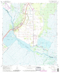
1967 Map of Des Allemands
USGS Topo · Published 1980About this map
Bayou Des Allemands forms the central spine of this landscape, separating the parishes of St. Charles and Lafourche. This region, documented during the late 1960s with late 1970s revisions, shows a complex network of industrial and natural waterways. The Paradis Oil and Gas Field dominates the northern terrain, crisscrossed by a numbered system of canals including Canal No 24 through Canal No 3. These artificial channels cut through the wetlands to service refineries and oil wells near the Southern Pacific railroad line.
Find a feature on this map
65 named features on this map. Tap any name to fly to it.
Don’t see what you’re looking for? This feature index may not catch every label — zoom into the map to look around manually.
Map Details
Editions of this 1967 Des Allemands Map
4 editions found
Other maps of this area

1891 · Hahnville
USGS Topo · 1:62,500

1892 · Lac Des Allemands
USGS Topo · 1:62,500

1892 · Cut-Off
USGS Topo · 1:62,500

1892 · Houma
USGS Topo · 1:62,500

1932 · Lac Des Allemands SE
USGS Topo · 1:31,680

1932 · Houma NE
USGS Topo · 1:31,680

1932 · Hahnville NW
USGS Topo · 1:31,680

1932 · Lac Des Allemands NE
USGS Topo · 1:31,680

1932 · Hahnville SW
USGS Topo · 1:31,680

1932 · Hahnville NE
USGS Topo · 1:31,680