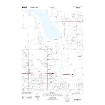
2013 Map of Des Moines NW
USGS Topo · Published 2013About this map
Camp Dodge serves as a dominant presence in this suburban Iowa landscape, bordered by the southern reach of Saylorville Lake. The map illustrates the 2013 development patterns of Johnston and Saylorville, showing how residential streets weave around established landmarks like the Iowa State University Experimental Farm. The Des Moines River flows through the center of the sheet, constrained by the Saylorville Dam Rd, while smaller water bodies like Beaver Cr and Rock Cr cut through the surrounding neighborhoods. This survey provides a clear look at the region's transportation and utility infrastructure just north of the state capital, including the aviation facilities at Kern Field Airport and Morningstar Field Airport. Settlement nodes such as Herrold and Lovington provide specific points of interest for local historians studying the growth of the Des Moines metropolitan fringe.
Find a feature on this map
82 named features on this map. Tap any name to fly to it.
Don’t see what you’re looking for? This feature index may not catch every label — zoom into the map to look around manually.
Map Details
Editions of this 2013 Des Moines NW Map
This is the sole edition of this map. No revisions or reprints were ever made.
Other maps of this area

1905 · Des Moines
USGS Topo · 1:62,500

1907 · Des Moines
USGS Topo · 1:62,500

1908 · Waukee
USGS Topo · 1:62,500

1911 · Madrid
USGS Topo · 1:62,500

1911 · Slater
USGS Topo · 1:62,500

1913 · Slater
USGS Topo · 1:62,500

1914 · Madrid
USGS Topo · 1:62,500

1954 · Des Moines
USGS Topo · 1:250,000

1956 · Des Moines
USGS Topo · 1:250,000

1956 · Des Moines NW
USGS Topo · 1:24,000