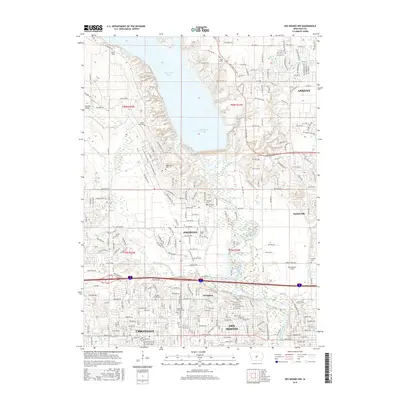
2015 Map of Des Moines NW
USGS Topo · Published 2015About this map
Saylorville Lake and the meandering Des Moines River dominate this 2015 perspective of the expanding suburban corridor north of Des Moines. The map details the transition from the dense residential developments of Urbandale and Johnston to the more open, aquatic landscape of the reservoir. Notable for local historians are the numerous cemeteries preserved amidst the modern growth, including McDivitt Grove Cem, Chapel Hill Gardens Cem, and Ridgedale Cem.
Find a feature on this map
156 named features on this map. Tap any name to fly to it.
Don’t see what you’re looking for? This feature index may not catch every label — zoom into the map to look around manually.
Map Details
Editions of this 2015 Des Moines NW Map
This is the sole edition of this map. No revisions or reprints were ever made.
Other maps of this area

1905 · Des Moines
USGS Topo · 1:62,500

1907 · Des Moines
USGS Topo · 1:62,500

1908 · Waukee
USGS Topo · 1:62,500

1911 · Madrid
USGS Topo · 1:62,500

1911 · Slater
USGS Topo · 1:62,500

1913 · Slater
USGS Topo · 1:62,500

1914 · Madrid
USGS Topo · 1:62,500

1954 · Des Moines
USGS Topo · 1:250,000

1956 · Des Moines
USGS Topo · 1:250,000

1956 · Des Moines NW
USGS Topo · 1:24,000