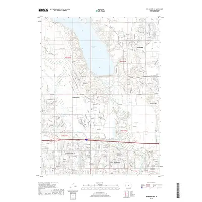
2018 Map of Des Moines NW
USGS Topo · Published 2018About this map
Saylorville Lake dominates the upper-central landscape of this Des Moines-area survey, where the Des Moines River and its backwaters, including Fisher Lake and Lake Loop, define the terrain north of the city. The map documents the extensive suburban expansion of Ankeny, Johnston, and Urbandale, showing a dense network of residential streets and arterial roads like NW Beaver Dr and Meredith Dr. For local historians and genealogists, the sheet is particularly dense with burial sites, preserving the locations of Union Cem, Valley View Cem, Ridgedale Cem, and Rittgers Cem. These sites, along with smaller landmarks like Kinsey Cem and Morningstar Field, provide essential anchor points for tracing the lineage of families who settled the townships of t80n r25w and t79n r24w before the modern suburban footprint took shape.
Find a feature on this map
176 named features on this map. Tap any name to fly to it.
Don’t see what you’re looking for? This feature index may not catch every label — zoom into the map to look around manually.
Map Details
Editions of this 2018 Des Moines NW Map
This is the sole edition of this map. No revisions or reprints were ever made.
Other maps of this area

1905 · Des Moines
USGS Topo · 1:62,500

1907 · Des Moines
USGS Topo · 1:62,500

1908 · Waukee
USGS Topo · 1:62,500

1911 · Madrid
USGS Topo · 1:62,500

1911 · Slater
USGS Topo · 1:62,500

1913 · Slater
USGS Topo · 1:62,500

1914 · Madrid
USGS Topo · 1:62,500

1954 · Des Moines
USGS Topo · 1:250,000

1956 · Des Moines
USGS Topo · 1:250,000

1956 · Des Moines NW
USGS Topo · 1:24,000