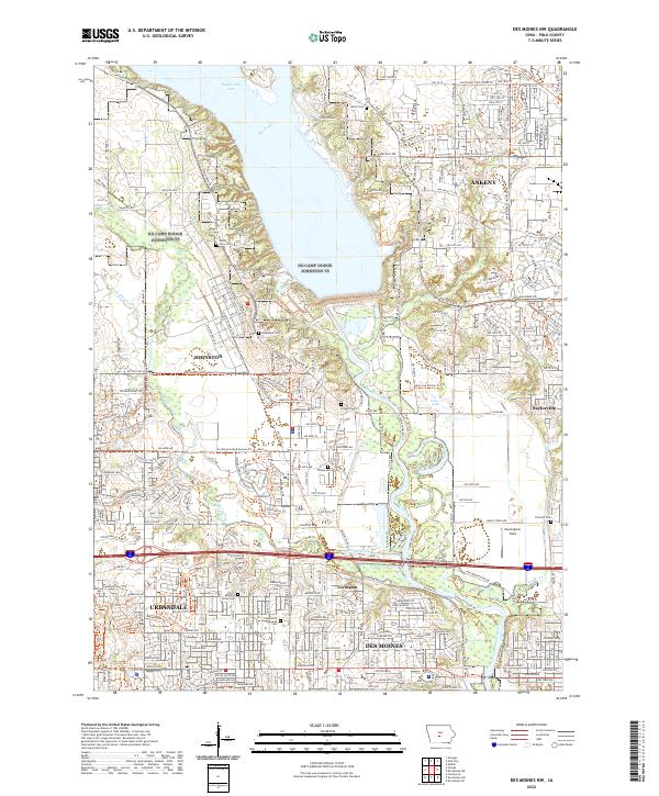
2022 Map of Des Moines NW
USGS Topo · Published 2022About this map
Saylorville Lake dominates the northern landscape of this Polk County region, where the Des Moines River flows south toward the state capital. The suburban expansion of Urbandale, Johnston, and Ankeny is well underway, yet the map preserves numerous small family and community burial grounds that predate the modern developments. Genealogists can locate Ridgedale Cem, Mcdivitt Cem, and Chapel Hill Gardens Cem, alongside several others like Kinsey Cem and Grove Cem tucked between residential blocks. The legacy of early 20th-century transportation is visible in the Interurban Trl, a recreational path following the alignment of the old Inter-Urban Tri electric railway. To the east, the settlement of Saylorville sits near the confluence of Saylor Cr and the river, while Morningstar Field occupies a central position east of Beaver Creek.
Find a feature on this map
206 named features on this map. Tap any name to fly to it.
Don’t see what you’re looking for? This feature index may not catch every label — zoom into the map to look around manually.
Map Details
Editions of this 2022 Des Moines NW Map
This is the sole edition of this map. No revisions or reprints were ever made.
Other maps of this area

1905 · Des Moines
USGS Topo · 1:62,500

1907 · Des Moines
USGS Topo · 1:62,500

1908 · Waukee
USGS Topo · 1:62,500

1911 · Madrid
USGS Topo · 1:62,500

1911 · Slater
USGS Topo · 1:62,500

1913 · Slater
USGS Topo · 1:62,500

1914 · Madrid
USGS Topo · 1:62,500

1954 · Des Moines
USGS Topo · 1:250,000

1956 · Des Moines
USGS Topo · 1:250,000

1956 · Des Moines NW
USGS Topo · 1:24,000