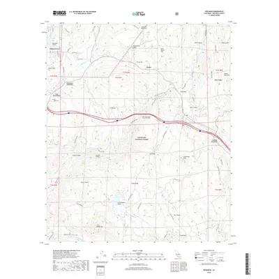
2018 Map of Descanso
USGS Topo · Published 2018About this map
Pine Valley and the surrounding highlands of the Cleveland National Forest dominate this landscape during a period of modern forest management and rural residency. The map reveals a complex network of canyons and peaks, including the prominent Corte Madera Mtn and Guatay Mtn, which define the local drainage patterns for the Sweetwater River and Pine Valley Cr. This survey illustrates how transportation has adapted to the terrain, featuring the Nello Irwin Greer Memorial Bridge and an intricate system of forest roads such as Corte Madera Rd and Bear Valley Rd. For those researching local history or genealogy, the presence of the Ellis Ranch Cem near Los Terrenitos provides a specific point of interest, while the numerous named valleys like Samagatuma Valley and Bear Valley highlight the pockets of settlement that have persisted throughout the region's development.
Find a feature on this map
62 named features on this map. Tap any name to fly to it.
Don’t see what you’re looking for? This feature index may not catch every label — zoom into the map to look around manually.
Map Details
Editions of this 2018 Descanso Map
This is the sole edition of this map. No revisions or reprints were ever made.
Other maps of this area

1903 · Cuyamaca
USGS Topo · 1:125,000

1904 · Southern California Sheet No. 2
USGS Topo · 1:250,000

1931 · Carrizo
USGS Topo · 1:125,000

1939 · Campo
USGS Topo · 1:62,500

1942 · Potrero
USGS Topo · 1:48,000

1942 · Campo
USGS Topo · 1:62,500

1942 · Cuyapaipe
USGS Topo · 1:62,500

1942 · Cuyamaca Peak
USGS Topo · 1:62,500

1944 · Potrero
USGS Topo · 1:62,500

1944 · Cuyamaca Peak
USGS Topo · 1:62,500