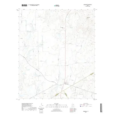
2019 Map of Desdemona
USGS Topo · Published 2019About this map
Desdemona stands at the convergence of Eastland, Erath, and Comanche counties, serving as the central settlement in a landscape defined by rolling hills and intermittent drainages. This recent topographic study documents the intricate network of ranch roads and county routes that bind the rural community together, including Ranch Rd 2214 and FM 8. Significant local landmarks like Mockingbird Hill and Rattlesnake Mtn rise above the drainage basins of the Leon River and the S Fork Palo Pinto Cr. The presence of several private water bodies, such as Love and Rodgers Lake Number 3 and Howard Wade Lake, suggests a landscape managed for ranching and water conservation. Genealogists and local historians will find the Howard Cem located east of the main townsite, providing a specific point of interest for tracing family roots in this tripartite county border region.
Find a feature on this map
50 named features on this map. Tap any name to fly to it.
Don’t see what you’re looking for? This feature index may not catch every label — zoom into the map to look around manually.
Map Details
Editions of this 2019 Desdemona Map
This is the sole edition of this map. No revisions or reprints were ever made.
Other maps of this area

1890 · Stephenville
USGS Topo · 1:125,000

1894 · Eastland
USGS Topo · 1:125,000

1920 · Stephenville
USGS Topo · 1:125,000

1954 · Abilene
USGS Topo · 1:250,000

1958 · Abilene
USGS Topo · 1:250,000

1965 · Huckabay SW
USGS Topo · 1:24,000

1965 · Lingleville
USGS Topo · 1:24,000
1965 · Reddy Mountain
USGS Topo · 1:24,000

1966 · Kokomo
USGS Topo · 1:24,000
1966 · Desdemona
USGS Topo · 1:24,000