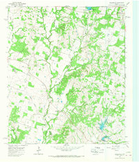
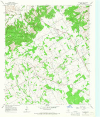
1965 Map of Lingleville
USGS Topo · Published 1967About this map
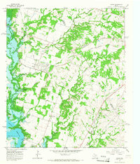
Lingleville sits at the northeastern corner of this mid-1960s landscape, serving as a hub for the surrounding ranch and farm lands of Erath County. The terrain is deeply inscribed by a drainage network including Hackberry Creek, Henning Creek, and the Leon River in the southwest, where several small impoundments such as Dam No 5 and Dam No 10 reflect local water management efforts. Rural life is anchored by small communities and gathering places like Highland and Victor, along with several country churches including Bethel Ch and Round Grove Ch. Genealogists will find the West End Cem and Bethel Cem clearly marked. A significant historical trace is found in the Old Railroad Grade that cuts diagonally across the western half of the map, marking a former transportation corridor through the rolling country south of the Dry Fork Armstrong Creek.
Find a feature on this map
30 named features on this map. Tap any name to fly to it.
Don’t see what you’re looking for? This feature index may not catch every label — zoom into the map to look around manually.
Map Details
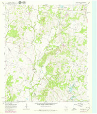
Editions of this 1965 Lingleville Map
2 editions found
Other maps of this area

1890 · Stephenville
USGS Topo · 1:125,000

1894 · Eastland
USGS Topo · 1:125,000

1920 · Stephenville
USGS Topo · 1:125,000

1954 · Abilene
USGS Topo · 1:250,000

1958 · Abilene
USGS Topo · 1:250,000
1965 · Huckabay SW
USGS Topo · 1:24,000
1965 · Dublin
USGS Topo · 1:24,000

1965 · Bunyan
USGS Topo · 1:24,000
1965 · Huckabay
USGS Topo · 1:24,000
1965 · Comyn
USGS Topo · 1:24,000