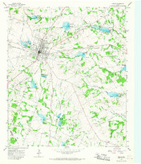
1965 Map of Dublin
USGS Topo · Published 1967About this map
Dublin serves as a significant rail crossroads in the mid-1960s, where the Atchison Topeka and Santa Fe and Missouri - Kansas - Texas railroads intersect. The town landscape is defined by its local infrastructure, including Memorial Stadium, a Rodeo Ground, and the Old Dublin Memorial Park Cem. Beyond the city limits, a complex water management system is evident through a series of flood control structures like Green Creek Dam No 7 and Dam No 14. These dams regulate the flow of Green Creek and its many tributaries, including Resley Creek and Kirkendell Branch. The surrounding Erath County countryside is dotted with small communities such as Alexander and Shiloh, alongside numerous Gravel Pit operations that hint at the era's local extractive industry.
Find a feature on this map
39 named features on this map. Tap any name to fly to it.
Don’t see what you’re looking for? This feature index may not catch every label — zoom into the map to look around manually.
Map Details
Editions of this 1965 Dublin Map
This is the sole edition of this map. No revisions or reprints were ever made.
Other maps of this area

1888 · Hamilton
USGS Topo · 1:125,000

1890 · Stephenville
USGS Topo · 1:125,000

1894 · Hamilton
USGS Topo · 1:125,000

1920 · Stephenville
USGS Topo · 1:125,000

1954 · Brownwood
USGS Topo · 1:250,000

1954 · Abilene
USGS Topo · 1:250,000

1956 · Gustine
USGS Topo · 1:62,500

1956 · Hico
USGS Topo · 1:62,500
1956 · Proctor
USGS Topo · 1:24,000
1956 · Edna Hill
USGS Topo · 1:24,000