1965 Map of Lingleville
USGS Topo · Published 1979About this map
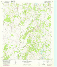
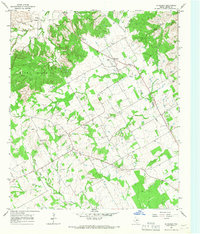
Lingleville serves as the primary settlement in this mid-1960s topographic survey, which documents a landscape of agriculture and intermittent industry along the Erath and Comanche county line. The terrain is defined by the drainage of the Leon River and Armstrong Creek, with numerous earth-fill dams such as Dam No 5 and Dam No 11 managing local water resources. Significant for local historians is the depiction of the Old Railroad Grade cutting across the countryside, marking the path of a former rail corridor that once linked these rural communities.
Find a feature on this map
29 named features on this map. Tap any name to fly to it.
Don’t see what you’re looking for? This feature index may not catch every label — zoom into the map to look around manually.
Map Details
Editions of this 1965 Lingleville Map
2 editions found
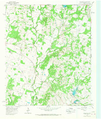
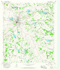
Other maps of this area

1890 · Stephenville
USGS Topo · 1:125,000

1894 · Eastland
USGS Topo · 1:125,000

1920 · Stephenville
USGS Topo · 1:125,000

1954 · Abilene
USGS Topo · 1:250,000

1958 · Abilene
USGS Topo · 1:250,000
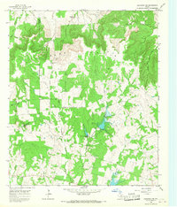
1965 · Huckabay SW
USGS Topo · 1:24,000
1965 · Lingleville
USGS Topo · 1:24,000
1965 · Dublin
USGS Topo · 1:24,000

1965 · Bunyan
USGS Topo · 1:24,000
1965 · Huckabay
USGS Topo · 1:24,000