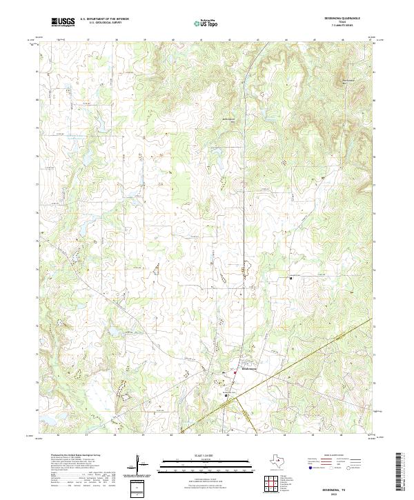
2022 Map of Desdemona
USGS Topo · Published 2022About this map
Desdemona serves as the primary focal point of this West Texas landscape, situated near the intersection of FM 8 and Ranch Rd 2214. The town is flanked by historic burial grounds, including the Desdemona Cem to the southwest and Howard Cem to the northeast, providing significant reference points for genealogical research. The terrain is defined by a network of seasonal watercourses and small ranching impoundments, with the Leon River winding through the southwestern corner and several named forks like S Fork Palo Pinto Cr and Red Fork Rush Cr draining the northern hills.
Find a feature on this map
51 named features on this map. Tap any name to fly to it.
Don’t see what you’re looking for? This feature index may not catch every label — zoom into the map to look around manually.
Map Details
Editions of this 2022 Desdemona Map
This is the sole edition of this map. No revisions or reprints were ever made.
Other maps of this area

1890 · Stephenville
USGS Topo · 1:125,000

1894 · Eastland
USGS Topo · 1:125,000

1920 · Stephenville
USGS Topo · 1:125,000

1954 · Abilene
USGS Topo · 1:250,000

1958 · Abilene
USGS Topo · 1:250,000

1965 · Huckabay SW
USGS Topo · 1:24,000

1965 · Lingleville
USGS Topo · 1:24,000
1965 · Reddy Mountain
USGS Topo · 1:24,000

1966 · Kokomo
USGS Topo · 1:24,000
1966 · Desdemona
USGS Topo · 1:24,000